IDUKKI


Munnar- The Kashmir of the South


It is one of the attractions that contributed to Kerala''s popularity as a travel destination among domestic and foreign travellers. Situated at the confluence of three mountain streams - Muthirapuzha, Nallathanni and Kundala, and perche d about 1600 m above sea level, the hill station of Munnar once
used to be the summer resort of the erstwhile British administration in south India.


This hill station is marked by vast expanses of tea plantations, colonial bungalows, rivulets, waterfalls and cool weather. It is also an ideal destination for trekking and mountain biking.

Let us now explore some of the options in and around Munnar that would provide travellers ample opportunities to enjoy the captivating hill station of Munnar.


  VAGAMON


                                       It is a very ideal tourist spot surrounded by the greenery of tea gardens, beautiful meadows, deep puzzling valleys and dales. The enchanting hill station dotted with tea gardens will soon be one of India's foremost eco-tourism projects.
 All the trekking enthusiasts will enjoy climbing this 1100 metres tall hill. This tourist place also has to offer Thangal Para, the Indo-Swiss Project and Kurisumala Ashram. Welcome to a land which would make you come back again and again. So that you could rejuvenate yourself and cherish memories of this enchantingly beautiful land.


If you have not been to Vagamon you have not seen God's Own Country. Vagamon provides unlimited holidaying fantasies round the year, except with the season being slightly off during the monsoons. Vagamon, the final word in your holiday options, provides unlimited holidaying fantasies round the year, except with the season being slightly off during the monsoons. A land, which would make a person come back again and again, so that you could rejuvenate yourself and cherish memories of this enchantingly beautiful land.
Water fall
This is essentially a lake and it's catchment area, with grassy hillocks stretching into the forest on one side and ending at the cliff on the other. This large tract of land has a small stream originating at the lake and going through.

Water falls and the ravine. The steep hill tract which provides access to the water fall area is along the ridge and there can be many pavilions along that to enjoy rain, wind, and the infinite view of the hillscapes. There can also be performance podiums with the mountainous landscape as the background.
The stream goes along the ravine and can be developed as a trekking path as it is a rugged route, with rocks and rough undulations. A small facility like a coffee bar and the like would add the richness of the place with more participation. A reservoir up stream would ensure the presence of enough amount of water even during dry season. A stepped path leading to the water fall itself is a thing of interest.

Rocky out crop
The steep rocky hill tract is almost mountainous in character. The cliff and ravine topography area is ideal for adventure activities that would attract people who like gliding, rope climbing, jumping and the like. There can be viewing pavilions too, as gufas in the vertical surface of the hill which would attract people for staying inside. This can be carved out of the rocks and would provide an adventurous stay.
Forest
Around 100 acres of forest area could be developed as a holistic health care center with Ayurveda as the theme. Providing treatment, health care facility, rejuvenation centers, yoga and meditation center, naturopathy clinics, herbal garden etc. emphasizing the theme of living with nature and exploring the aeons old way of life. Tree walks, medicines preparation areas, etc. all designed to a character of ashrams.

Grassy planes
Features:
1. Eucalyptus plantation
2. Road side slope
3. Grassy hills
4. School hill
5. Cliff side

The area is rather featureless compared to other parts of the site, with grassy, slowly rolling plains. It has a direct access from the road and slopes down from there ending at the cliff. At present there are plantations of eucalyptus, tea and some agricultural crops here.

This plot section can be reserved for residential school or some similar institutional use. The relative flatness of the site and gentle slope is ideal for this. The land is generally buildable also.

The area near the main road could be reserved for exploiting the future commercial potential. This long strip can be developed for the future public amenities and facilities that have commercial viability. Land value will also increase as the place develops and demand for plots with accessibility will increase.

Camping site

A unique type of space with stream, rocky terrain and forest meet. This can be developed to a camping site, a small lake and a special abode, for evening tea and the like.
Lake
The entertainment center and related activities like boating leisure walking etc. could be organized around the lake. Lawned rolling hills and flowers that grow along the ground can be provided as a part of the landscaping. This should be developed with minimum intervention of built. This place (node) should be developed to communicate the essence of this site, to a passerby along the public road as this portion is visible from the road as a lake between three knolls. A stage for performance, crafts, arts center, pedestrian path etc. can concentrate around this node.

Wild Orchid
The area is a stretch of rolling hills with green meadows.
A unique cottage resort built in a rugged village style and is eco friendly in all features especially in the disposal of water, conservation of resources, building material use and construction techniques. A total of 50 cottages are coming up on one side of a beautiful lake and common facilities like restaurant, theatre etc. on other bank of the lake.

How to Reach
Vagamon is roughly 100 kms from Cochin, the commercial capital of the State. It is also 64 kms from Kottayam -the nearest railway station. It is easily accessible by road from Kottayam and Cochin. Other tourist attractions around Vagamon like Bird Sanctuary at Kumarakom, Hill resorts at Munnar, Kodaikanal etc. are easily accessible by road from Vagamon.


Eravikulam National Park
One of the main attractions near Munnar is the Eravikulam National Park. Located about 15 km from Munnar, this park is famous for its endangered inhabitant - the Nilgiri Tahr. Spread over an area of 97 sq. km., this park is also home to several species of rare butterflies, animals and birds. A great place for trekking, the park offers a magnificent view of the tea plantations and also the rolling hills caressed by blankets of mists. The park becomes a hot destination when the hill slopes here get covered in a carpet of blue, resulting from the flowering of Neelakurinji. It is a plant endemic to this part of the Western Ghats which blooms once in twelve years. The last time it bloomed was in 2006.
Anamudi Peak
Located inside the Eravikulam National Park is the Anamudi Peak. This is the highest peak in south India standing at a height of over 2700 m. Treks to the peak are allowed with permission from the Forest and Wildlife authorities at Eravikulam.
Mattupetty
Another place of interest, located about 13 km from Munnar Town, is Mattupetty. Situated at a height of 1700 m above sea level, Mattupetty is known for its storage masonry dam and the beautiful lake, which offers pleasurable boat rides, enabling one to enjoy the surrounding hills and landscape. Mattupetty''s fame is also attributed to the dairy farm run by the Indo-Swiss Livestock Project, where one would come across different high yielding breeds of cows. Mattupetty with its lush green tea plantations, rolling grasslands and the Shola forests is also ideal for trekking and is home to a variety of birds.


Pallivasal

Pallivasal, located at about 3 km from Chithirapuram in Munnar is the venue of the first Hydro-electric project in Kerala. It is a place of immense scenic beauty and is often favoured by visitors as a picnic spot.
Chinnakanal
Near the town of Munnar is Chinnakanal and the waterfalls here, popularly known as Power House Waterfalls, cascade down a steep rock 2000 m above sea level. The spot is enriched with the scenic view of the Western Ghat ranges.


Anayirangal
When you have traveled about seven kilometers from Chinnakanal, you reach Anayirangal. Anayirangal, 22 km from Munnar, is a lush green carpet of tea plants. A trip on the splendid reservoir is an unforgettable experience. The Anayirangal dam is surrounded by tea plantations and evergreen forests.
Top Station
Top Station, which is about 32 km from Munnar is at a height of 1700 m above sea level. It is the highest point on the Munnar-Kodaikanal road. Travellers to Munnar make it a point to visit Top Station to enjoy the panoramic view it offers of the neighbouring state of Tamil Nadu. It is one of the spots in Munnar to enjoy the Neelakurinji flowers blooming over a vast area.
Tea Museum

Munnar has a legacy of its own when it comes to the origins and evolution of tea plantations. Taking account of this legacy and to preserve and showcase some of the exquisite and interesting aspects on the genesis and growth of tea plantations in Kerala''s high ranges, a museum exclusively for tea was opened some years ago by Tata Tea in Munnar. This Tea Museum houses curios, photographs and machineries; all of which have a story to tell on the origins and growth of tea plantations in Munnar. The museum is located at the Nallathanni Estate of Tata Tea in Munnar and is worth a visit.

Idukki Arch Dam, IdukkiIdukki Arch Dam 
Idukki Arch Dam is the world's second and Asia's first arch dam, constructed across the Kuravan and Kurathi hills. This dam is about 550 feet high and 650 feet wide, and lies close to the Cheruthoni barrage. The Kulamavu Dam lies to its west and Idukki wildlife sanctuary is located close by.


IdukkiWildlifeSanctuary 


Idukki Wildlife sanctuary extends over the Thodupuzha and Udumpanchola taluks of Idukki district. This sanctuary spreads over an area of 77 square km and is located about 450 - 748 m above sea level. The Idukki reservoir is formed by three dams - Cheruthoni, Idukki and Kulamavo, and extends to 33 square km. Various animals like elephant, bison, sambar deer, wild dog, jungle cat, tiger, wild boar, snakes like cobra, viper, krait and a number of non poisonous snakes and birds like Jungle fowl, myna, laughing thrush, black bulbul, peafowl, woodpecker, kingfisher, etc can be seen in this sanct2C e


Nadukani
Nadukani is an ideal place for one day picnickers. It offers a panoramic view of a large area than one can experience from any high mountain peak. A two-storeyed pavilion makes an ideal place for enjoying the landscape and beauty of nature.


ThumpachiCalveriSamuchyam
Thumpachi Calveri Samuchyam is a picnic spot also ideal for meditation, relaxation and watching sunset
.Located approximately 35 km from Thodupuzha, Thumpachi Calveri Samuchayam is a famous spot for meditation and relaxing. The cool and scenic ambiance is also perfect for enjoying sunsets.


Kalliyanathandu
Kalliyanathandu, about 10 km from Idukki is a splendid tourist spot. It offers the aerial view of the Idukki reservoir, panoramic view of the peaks and forests. It is also an ideal place for mountain climbers and trekkers.
 :350.2

KULAMAVU


Kulamavu lies in Idukki district, Kerala, South India.
Kulamavu is known for its dam which is a part of the Idukki Hydro Electric Project.The Idukki arch dam (Asia’s first arch dam) is supported by two other smaller dams - one at Cheruthoni and the other one at Kulamavu.
Boating in the artificial lake at the dam is an enjoyable experience. Various species of birds have been sighted in this area.Some of the common ones are: darter or snake bird and king fisher.
Being in the lower part of the high ranges of Kerala, Kulamavu enjoys a salubrious climate.Rubber and spice plantations flourish here.With a height of 3,000 ft above the sea level, Kulamavu is one of the famous hill stations in Idukki, Kerala. It is an ideal place for trekking and tourists are sure to enjoy the ariel view of the area while trekking.
Kulamavu Dam, which is one of the three dams of Idukki Reservoir Project, is the main attraction of the Kulamavu. Stationed at the western side of Idukki Arch Dam, the world's second arch dam, Kulamavu extends between rocky hills to form the 33 Sq.km reservoirs.
Boats are also available for 2 hrs cruise between Cheruthoni and Kulamavu dams. Other nearby places of interest includes Moolamattom underground power station and Idukki Wildlife Sanctuary.


CHERUTHONI


Constructed in 1976, the largest concrete gravity dam in Kerala, Cheruthoni, is located close to Idukki Arch Dam. Built across the Periyar River, it is also the third highest dam in India. You can reach Cheruthoni only by jeep. The Kerala State Electricity Board (KSEB), which looks after the dams, rents out boats for the two-hour cruise between Cheruthoni and Kulamavu. Visitors get splendid views of sunrise and sunset from here. With an altitude of about 3900 ft, Cheruthoni Dam is easily accessible from Idukki Wildlife Sanctuary. 

Best Season: August to MarchTransport Terminals: 5 kms from PainavuHow to Reach: Nearest Railway Station: Kottayam (133 kms away)
Nearest Airport: Cochin International Airport (132 kms away)


THOMMANKUTHU 


Set in the lush green surroundings, Thommankuthu waterfalls in Idukki district, Kerala is one of the most serene and beautiful cascades of Kerala. Situated about 20 km from Thodupuzha town, this splendid waterfall comes down in seven steps with a cascade and a pool at each step. This enchanting place with its natural splendour is also an ideal venue for adventure tourism. 

To enjoy the panoramic beauty the best way is to undertake a trek that takes one to the top of the mountain, a nearly 12 kilometres climb. Under the present circumstance only one-day tours can be conducted owing to the lack of boarding and lodging facilities. The Chitrakoodam project aims at installing essential and basic facilities here. Boating can be arranged in the serene lake. Fishing, together with horse riding in the valleys and adventure sports are also possible.

This exotic place is congenial for trekking or mountain climbing. Tourists looking for adventure can trek the mountain, which is around 12 km of climbing. Since there are no accommodation facilities available at this site, tourists can enjoy only one-day tours. Tourists can also enjoy boating on the lake. Fishing and horse riding are other options available in this pleasant valley.

If you are interested in visiting this amazing Kerala highlight, you can board a bus from Thodupuzha, 18 km from Thommankuthu. For lodging, there are many hotels, rest houses and restaurants at Thadupuzha. The nearest railway station is Nedumbassery Airport, which is 80km away. The nearest railway stations are at a distance of 60 km away at Kochi and Kottayam.


Best time to visit – June to October i.e. from start till end of Monsoon

HowtoReach :
By Rail: Ernakulam, about 58 km away from Thodupuzha and at a distance of 60 km is the Kochi and Kottayam railway station.
By Air: Cochin International Airport, about 70 km from Thodopuzha.
By road: 20kms from Thodupuzha by Munnar-Thommankuthu bus.


KEEZHARKUTHU 


Keezharkuthu falls, also called as Rain Bow waterfalls is a must see place in Idukki district of Kerala. The waterfalls cascade down a rock from a height of about 1,500m. It can be witnessed throughout the year in full swing. The surrounding forest of the waterfalls is the home of several medicinal plants. The spot is also ideal for enjoying adventurous activities like rock climbing, mountaineering and camp tracking.


Trek to Keezharkuthu
It happened! All my fears were misplaced.
Route
Udumbannoor – Pariyaram – Kaithapara


We started from Udumbannoor at 7AM towards Pariyaram. The trek to Keezharkuthu starts from Pariyaram. And Pariyaram will be the last place to stock up your supplies before you start the trek.


From Pariyaram, we entered the forest. There was hardly any serious trek involved till we reached the turn to Keezharkuthu falls from Kaithapara. There is a winding jeep road towards Kaithapara. If you are very adventurous, you can traverse the hill straight up like we did.

How to reach Udunbannoor

Kerala -> Idukki -> Thodupuzha -> Udumbannoor

Kaithapara-Keezharkuthu


Getting there:


Nearest railway stations: Theni (Tamil Nadu), about 60 km away; Ernakulam about 130 km away.
Nearest airports: Madurai (Tamil Nadu), about 140 km away; Nedumbassery International Airport, about 125 km away.

THRISSUR


Thrissur which is Kerala’s cultural capital is very famous for the temples and the main attractions include the fairs and festivals of the temples. The cultural centre of Thrissur which is Kerala Kalamandalam is a place you can visit. There are many archaeological buildings and monuments here which are must visit. The monuments including forts, palaces, museums etc are Cranganore fort, Shakthan Thampuran palace, Archaeological museum etc. The natural attractions in Thrissur are waterfalls and wildlife reserve areas. It includes Athirapally and Vazhachal waterfalls, Chimmini wildlife, Peechi Vazhani etc. There are 2 water theme parks in Thrissur namely Dream World and Silver Storm water theme parks. Tourists come here in large numbers to the theme parks. One out of the 2 Zoos of Kerala are in Thrissur. Another attraction here is the largest elephant park called the Punnathur kotta Elephant Sanctuary. The main places of interest in Thrissur district are given below

CranganoreFort


Cranganore Fort which is also known by the name Kodungallur Fort is in Thrissur district. Another name for this fort is Kottappuram fort. The word meaning of ‘Kottappuram’ is ‘the place around a fort’.  It was constructed in the year 1523 by the Portuguese.  


ShaktanThampuranPalace

Shakthan Thampuran Palace is located in Thrissur district. This palace is now preserved by the Archaeological department. At present it is a museum. The building is two a museum. The building is two storied and is in the Na is two storied and is in the Nalukettu form. The roof is very high and has thick walls. The flooring is done using Italian marbles. The interiors of the palace are constructed in such a way that it provides comfort irrespective of the weather condition.  


ArchaeologicalMuseum

The Archaeological Museum which is situated in Thrissur is famous for its huge and rare collection of artifacts. The Archaeological museum was established by the Government of Cochin in the year 1938 as Sree Mulam Chithrasala which is a picture gallery. The exhibits at that time were the crafts work of copies of murals in Mattancherry palace and some other temples.  


ChimminiWildlife

Chimmini wildlife sanctuary is located near the Nelliampathy in Thrissur district. It was established in the year 1984 and part of this lies near to the Peechi-Vazhani wildlife sanctuary and the next part lies near the Parambikulam sanctuary. Chimmini is at a height of about 40 m to 1,116 m above sea level. The highest point here is the Punda Peak.  

Peechi-Vazhani

Peechi-Vazhani Sanctuary is located in Thrissur district. It lies in the basin of Peechi – Vazhani dam. The total area of this sanctuary is 125 sq kms and is a portion of the Nelliyampathy forest. It is the second oldest sanctuary in Kerala and was established in the year 1958. The highest peak of this area is Ponmudi peak.  

DreamWorldPark

Dream World Park is a water theme park in Thrissur district. It is located at a distance of 24 kms from the famous Athirapalli waterfalls. On the entrance of the park huge dragons are built that attracts every one. Thousands of tourists visit this park and a unique feature of this park is that the rides are designed in a manner that tourists of all age can enter those without any difficulty.  
Roma0ASilverStorm

Silver Storm water theme park is located in Vettilapara in Thrissur district. The rides here are a combination of natural wonder and manmade marvels. This park was established with the financial aid of Kerala State Industrial Development Corporation Ltd (KSIDC). This park was launched in 5 phases, first being in 2000 and the final phase in 2005.  

ThrissurZoo

Thrissur zoo was established in the year 1885 in Chembukavu in Thrissur district. It covers a total area of 13 acres of land. There are a wide variety of animals, reptiles, birds etc. Within the zoo premises lies the Zoological garden, botanical garden, art museum and a natural history museum.  

KeralaKalamandalam

Kerala Kalamandalam is located in Cheruthuruthy which is home to the Kathakali dance form. This institution was established in the year 1930 by the famous Malayalam poet Vallathol Narayana Menon. Students get trained in Kathakali from this Kalamandalam and many best Kathakali performers have studied here. Besides Kathakali, music, drama and various other dance forms are trained from here.

PunnathurKottaElephantSanctuary

Punnathur Kotta is the largest elephant park in the world and there are around 60 elephants here. All the elephants found here are donated to Lord Guruvayoorappan by his devotees. Some of the main attractions here are the elephant race and the feast for the elephants. The elephants of all age group are found here and they live here in a natural habitat. The elephants are also trained to participate in the Guruvayoor temple festivals. People can go near the elephants and take a look at them. 


Places of Interest
Adur
The place is famous for Annamanada Temple. Annamanada was the venue of two historic interviews between the rulers of Travancore and Cochin in the later part of the eighteenth century. The famous Nedumkotta of 'Travancore Lines' built by Dharma Raja of Travancore to meet the menace of the Mysore invasion passes through Adur. 
   
Arattupuzha
It is famous for the Arattupuzha Pooram Festival held in March - April every year. During this festival, idols of deities from 46 neighboring villages are brought to the temple at night in procession on caparisoned elephants. This colorful festival attracts a large number of people from different parts of the state.
Arthat
One of the oldest Jacobite Syrian Churches in the District is situated at Arthat. The Church property was the the subject of a prolonged dispute between the Jacobites and the Reformed Syrians.The main cottage industries are mat-making, rattan work and pottery.
It is a place of historical importance as it was here that Tipu Sultan established the base of when his army was besieging the "Travancore Lines". It is the centre of communications with the eastern uplands. The town enjoys reputation of being  one of the healthiest spots in the District. It is a place worthy of visit and sight seeing. A few miles away from Chalakkudy Irrigation Project and 26 miles east of the town is the Peringalkuthu Hydro-electric project.
  
Chelakkara
It was the seat of the powerful Pisharoti Chief Tottassery Talachennaver who was deprived of his estates in 1767 for submission to the Zamorin. Exactly five year earlier Chelakkara was the theatre of a pitched and decisive battle between Tranvancore and Cochin forces on one side and the Zamorin's forces on the other, in which the soldier of the Zamorin were thoroughly routed.
Cheruthuruthy
The Bharathapuzha is here spanned by a fine bridge. On the opposite side is the Shornur Railway Station. Cheruthuruthy is famous as the seat of the Kerala Kalamandalam founded by the Poet Vallathol Narayana Menon, to encourage the study of the ancient arts of Kerala such as Kathakali and Mohiniyattam. Now the Kerala Kalamandalam is functioning at Vallathol Nagar, with its new building complex and Natyagrapha. The old Kerala Kalamandalam is still at Cheruthuruthy on the shore of Nila River. The Samadhi (Tomb) of the Poet Vallathole the founder of this famous institution is in the premises of old Kala Mandalam.
It is said to have been a great centre of education. It has a Subja Mutt where young Namboodiris were given free education in Sanskrit. They were provided with free boarding and lodging. The Cochin Devaswom Board runs the Subja Mutt aswo today, though the number of pupils receiving instruction is small.
Chavakkad
The mausoleum of Haidross Kuttee, Haidor Alis Lietutenant is situated at the Manathala desam near Chavakkad. Disgusted with his masters oppression Haidros Kuttee is said to have revolted and died in the battle. Because of its association with Haidross Kuttee Chavakkad is also sometimes called Kuttingal. At Palayar, half a mile from Chavakkal Road is a Roman Syrian Christian Church which according to tradition is one of the seven churches founded by St. Thomas on the West Cost.
Kodungallur
It is a place of great historical interest. Kodungallur was a great emporium of trade even before the dawn of Christian era.Situated at the confluence of the Periyar river system with the Arabian Sea it possessed in the past unique facilities for trade and commerce within and without.The Jews,the phoenicians, the Greeks the Romans and the Arabs came here with their merchandise.From here ivory,sandalwood, peacock's feathers and cinnamon     were exported to foreign countries. The Roman colonists are said to have founded here a temple in honor of Augustus. Early Tamil Poets called it Muchiri. The Jews, Christians and Muhammedans all claim it as the place of their first settlement in India. The port and its suburbs figure Thiruvanchikulam in Kodungallur was the Capital of the Chera Kings of the Sangam.

Guruvayoor
Nearly two and a half kilometres to the east of Chavakkad, is Guruvayur know as the seat of one of the holy temples dedicated to Lord Krishna.
According to tradition the temple is the creation of Guru, the preceptor of the Deva and Vayu the Lord of winds. The Vigraha Pratishta or the installation and Vayu and hence the name Guruvayurappan. A series of legends have been woven round the origin of the temple. The temple was famous even in 16th Century. The great Ekadasi festival held annually for five days in the month of Vrischikam (November- December) is very largely attended. The ever increasing influx of pilgrims to this temple indicate its great popularity.     Mandalam and Visakam are the two important festival seasons of Guruvayur.  

Irinjalakuda
The most important institution in the town is the large and well endowed temple of Koodalmanikam. The deity enshrined therein is prince Bharatha, brother of Sree Rama. Koodalmanikkam the idol for comprison had been absorbed by it. It is a temple with large landed property.  

Kunnamkulam is Municipal town. It is the Chief centre of Jacobite Syrian Christians. There     are several old Church in the town and the neighbourhood. The remains of an old fort are found here.

Mala
In the early times Mala was the colony of Jews. Ambalakad convent, one of the largest monastries in the district is situated near Mala close to the monastry are seen the remains of the one famous seminary of Chemballor (St.Paul's William) founded by Jesuit priests in the 16th century. One of the first printing presses in the country was established in this seminary and the first Malayalam book was printed here by about 1957. The 'Pambummekkattumana', a serpent grove under the control Pambummekkattu Namboodiri, is situated a mile away from Mala.
Mullurkara
It was the seat of the Manakot Nair, the chief of Ayirunad who was dispossessed of his estates by about 1740 for accepting the Zamorins Suzerainty. The estate then came into the possession of Paliyath Achan. Traces of a port built by Achan in 1740 to protect the region from the Zamorian's forces can be seen here.
    
Nelluvai
The ruins of an extensively fort built in a line of hills are found in this village. There is a temple dedicated to Lord Krishna which attracts worshippers from various parts of the district.
  
Ollur
The place is noted for title industry and packing case business. A large volume of trade in timber including plywood is also carried on. Synthetic stones are imported from Switzerland and they are polished here and exported to foreign countries.
  
Peechi
The Peechi dam site about 14 miles east of Trichur has developed into one of the main tourist centres of the District . It is a beauty spot offering ample scope for excursions and picnics . It was constructed with the object of harnessing the waters of the Manali river.
   
Chimmoni Wildlife Sanctuary
Established in 1984, the Chimmoni Wildlife Sanctuary lies   contiguous to the Peechi-Vazhani sanctuary, it is endowed with scenic beauty and a rich and varied wildlife. Elephant, sambar, gaur, Malabar squirrel, sloth bear etc. can be seen here.
chimmoni
Athirampilly Waterfalls
It is near to the entrance of the Sholayar range is a place of great scenic beauty. Here, the water plunges from a height of nearly 80 feet before joining the Chalakudi river. Vazhachal is just a drive from Athirampally, this picturesque spot is adjacent to Jense green forest, and is a part of Chalakudi River....
Sholayar Dam
The Dam is constructed in Chalakudy river and it is 65 km. East of Chalakudy town. The beauty of Athirappilly Water fall and Sholayar Dam can be enjoyed on the way to Sholayar
   
Vazhani Dam
This is an Eastern Dam with a length of 792.48 metres constructed in the Wadakkanchery river . The Dam is 10 k.m. away from Wadakkanchery .
   
Christian Divine Retreat Centre
Divine Retreat Centre is situated by the side of the National Highway 47, about 3 kms from Chalakudy town. The town has a bus stand and a railway station.
    
Shakthan Thampuran Palace

Also known as Palace Thoppu, the campus covers an area of 6 acres. Here you can see three shavakudeerams (tombs) including that of the renowned Shakthan Thampuran.

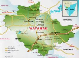
WAYANAD

WELCOME TO THE LAND OF SPICY HILLS WAYANAD...........  


The hills, rocks and valleys which contribute to the very unique terrain of Wayanad provide for exceptional adventure experiences. Mountains and forests intersperse to create numerous outback trails, trekking routes and opportunities for other adventure sports. With vast areas still unexplored, Wayanad is truly an adventure scape waiting to be discovered!Area: 2132 sq. km                                                   
Altitude: 700 - 2100 m above sea level
A bio-diverse region spread across 2,132 square kilometers on the lofty Western Ghats, Wayanad is one of the few districts in Kerala that has been able to retain its pristine nature. Hidden away in the hills of this land are some of the oldest tribes, as yet untouched by civilization. And the very first prehistoric engravings in Kerala discovered in the foothills of Edakkal and around Ambukuthimala bear testimony to a pre-historic culture dating back to the Mesolithic Age. Strikingly scenic, it is known for its sub-tropical savannahs, picturesque hill stations, sprawling spice plantations, luxuriant forests and rich cultural traditions. A holistic confluence of wilderness, history and culture, Wayanad is located on the southern tip of the magnificent Deccan plateau.
Lakkidi-The gateway of Wayanad, is situated 700 mts above the mean sea level, at the crust of Thamarassery Ghat pass. Lofty peaks, gurgling streams and luxurious forests add magic to the journey up the winding roads to this hill station.


             3 km south of Vythiri. The perennial fresh water lake, nestled among wooded hills, is a only one of its kind in Kerala. Set in a beautiful valley and surrounded by evergreen forests and wooded hills, Pookot is one of Wayanad's top visitor draws. This natural lake near Lakkidi is just a short distance off the NH-212. It has been developed as a recreational centre having boating facilities, children's park, fresh water aquarium etc. It is a good setting for day outings with family.


Distances from: KPA-15 Km, SBY-40 Km, MDY-50 Km
Chain Tree-This large Ficus tree, bound by a prominent chain is an interesting excursion, approximately 15 kms. from Kalpetta. It is said that a British Engineer, with the aid of a tribal guide named Karinthandan, found the difficult mountain terrain into Wayanad. Eager to take the credit for the discovery, the Engineer conveniently killed his guide, whose soul, according to the legend, constantly haunted subsequent travelers. It is believed that a priest chained the troublesome spirit onto this tree and hence name the Chain tree.
Distances from: KPA-15 Km, SBY-40 Km, MDY-50 Km

                                          Kalpetta  

                             Kalpetta, the district headquarters of Wayanad, is the only municipality in this hilly region. The town has hotels, bars, restaurants and shops, making it a convenient base to visit this place while at the same time enjoying these facilities.


Chembra peak-At 2100 mts above mean sea level, Chembra is the highest peak in Wayanad and is ideal for trekking. Climbing this peak is a challenging mountaineering endeavour and would take a full dayThe scenic beauty of Wayanad, which is visible from the top of Chembra, is very exhilerating. The surrounding areasoffer exceptional photo oppurtunities. Camping on the peak is an unforgettable experience. District Tourism Promotion Council provides guides, sleeping bags, canvases, huts and trekking implements on hire.

Distances from: Kalpetta (KPA)-14 Km, Sulthan Bathery (SBY)-42 Km, Mananthavady (MDY)-52 Km

Distances from: Kalpetta (KPA)-14 Km, Sulthan Bathery (SBY)-42 Km, Mananthavady (MDY)-52 Km


Neelimala View Point-Closer to Vaduvanchal, Neelimala is an excellent venue fro trekking with lots of stimulating trails. The summit of this hill affords a great view of the cascading Meenmutty fallsand the beautiful valley in its foreground.

Distances from: KPA-27 Km, SBY-26 Km, MDY-62 Km


Meenmutty falls


An interesting 2 km jungle trek off the main Ooty road, Meenmutty is the largest and most spectacular waterfall in Wayanad. A unique feature is that water drops about 300 metres over three stages.
Distances from: KPA-37 Km, SBY-12 Km, MDY-54 Km


Sentinal Rock Waterfalls-22 kms south of Kalpetta near Chooralmala. Locally known as Soochippara and is a very popular leisure destination. This is a three step waterfall more than 200 mts in height. Framed by enchanting scenery. A must to see site! This region is ideal for rock climbing. Soochipara can be reached by a scenic 2 kms. nature walk and deer and other wildlife can be seen near the waterfront.

Distances from: KPA-22 Km, SBY-43 Km, MDY-58 Km

Distances from: KPA-22 Km, SBY-43 Km, MDY-58 Km


Kanthanpara waterfalls-22 kms south east of Kalpetta and 8 kms east of Meppadi, a beautiful waterfall about 30 mts in height. Relatively smaller than Sentinel Rock falls, and rather less frequented Kanthanparaand its surroundings offer a very pleasant site. A easy hike away from the main road, its perfect for picnics.

Distances from: KPA-22 Km, SBY-23 Km, MDY-57 Km

Distances from: KPA-22 Km, SBY-23 Km, MDY-57 Km


Banasura sagar project-21 kms north east of Kalpetta. Situated at Padinjarathara. A mini hydel project with the largest earth dam in India and the second largest in Asia is being built here. The Banasura project precincts are an ideal starting point for treks to the Banasura Peak. A quaint feature is a series of islands that were formed when the reservoir submerged the surrounding areas.

Distances from: KPA-21 Km, SBY-47 Km, MDY-34 Km

Distances from: KPA-21 Km, SBY-47 Km, MDY-34 Km

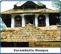
Varambetta Mosque-15 kms southeast of Kalpetta, near Padinjarathara: dating back 300 years, this is the oldest mosque in Wayanad.


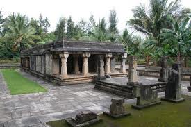
Jain Temple at Puliyarmala-4 kms north of Kalpetta. This old temple is dedicated to Ananthanatha Swami, one of the most revered Jain Saint.


Glasstemple, Koottamundu-This temple is located on the slopes of Vellarimala and is dedicated to Parshwanatha Swami of the Jain faith. The mirrors inside the temple wall reflect images of the icons in the temple's sanctum sanctorum.

NB: Permission is restricted now a days.
Sultan Bathery, also known as Sulthan's Battery lies approximately 25 kms. from Kalpetta. Associated with Hyder Ali and Tipu Sulthan, Sulthan's Bathery no longer has a fort. It is worth visiting for the Jain temple, which has some interesting stone carvings. Sulthan Bathery can be seen on a drive from Kalpetta to Wayanad Wildlife Sanctuary, Muthanga.

                                       SULTHAN BATHERY

Sultan Bathery, also known as Sulthan's Battery lies approximately 25 kms. from Kalpetta. Associated with Hyder Ali and Tipu Sulthan, Sulthan's Bathery no longer has a fort. It is worth visiting for the Jain temple, which has some interesting stone carvings. Sulthan Bathery can be seen on a drive from Kalpetta to Wayanad Wildlife Sanctuary, Muthanga.

Edakkal caves-12 kms from Sulthan Bathery. 3 caves are located at a height of 1000 mts on Ambukuthi mala near Ambalavayal. The new stone age pictorial writings on the walls of these natural caves at Edakkal are the evidence of the civilizations that existed in the regions in the pre-historic times. The caves can be accessed only by a 1Km trekking trail from Edakkal. Morning hours are the best time to visit these caves. Entry is permitted only upto 1700 hrs. An interesting trek up of the Ambukuthi Hill near Ambalavayal town takes you to this fascinating neolithic cave site. Etchings found on the walls of these caves have drawn the serious attention of archeologists and historians worldwide.


With at least three distinct sets of petroglyphs, the earliest thought to date back over 3000 years, it is assumed that the Edakkal caves had been inhabited at various stages in history.

Distances from: KPA-27 Km, SBY-12 Km, MDY-45 Km
Chethalayam Falls-Chethalayam is one of Wayanad's smaller waterfalls. Its surroundings offer a number of vantage points for bird-watching. It is also popular with trekking enthusiasts.

Distances from: KPA-37 Km, SBY-12 Km, MDY-54 Km
Muniyaras-Excavations at various points around the foot of the Ambukuthi Hill have unearthed a distinctive series of ancient burail vaults commonly called Muniyaras. Remnants of Stone Age tools and pottery found within these cellars are displayed at the Wayanad Heritage Museum.

Distances from: KPA-27 Km, SBY-11 Km, MDY-44 Km


WAYANAD WILD LIFE SANCTUARY, MUTHANGA-ESTABLISHED IN 1973, THE WAYANAD WILD LIFE SANCTUARY IS CONTIGUOUS TO THE PROTECTED AREA NETWORK OF NAGARHOLE AND BANDIPUR OF KARNATAKA ON THE NORTH-EAST ANDMUTHUMALAI OF TAMILNADU ON SOUTH-EAST. RICH IN BIO-DIVERSITY, THE SANCTUARY IS AN INTEGRAL PART OF THE NILGIRI BIOSPHERE RESERVE, WHICH HAS BEEN ESTABLISHED WITH THE SPECIFIC OBJECTIVE OF CONSERVING THE BIOLOGICAL HERITAGE OF THE REGION. THE SANCTUARY IS RICH IN FLORA AND FAUNA. THE MANAGEMENT LAYS EMPHASIS ON SCIENTIFIC CONSERVATION WITH DUE CONSIDERATION FOR THE GENERAL LIFE STYLES OF TRIBALS AND OTHERS WHO LIVE IN AND AROUND THE FOREST.

The vegetation is predominantly moist deciduous forest with small stretches of swamps, teak forests, bamboo and tall grass. Amidst such fertile and varied flora, this region hosts several rare herbs and medicinal plants.


With numerous watering holes Muthanga has a large population of pachyderms, and has been declared aProject Elephant site. Also Jungle Cats, Panthers, Civet Cat, Monkeys, Wild dogs, Deers, Spotted Bears, Bisons, Gaurs, Cheetah, Wild Bears, Peacock, Owls, Jungle fowls, Woodpeckers, Babblers, Cukoos etc.. can be seen here. Thekoos etc is also home to a small population of Tigers. Elephant rides are arranged here by the forest department.
 Permitting authority:


Wildlife Warden, Wayanad Wildlife sanctuary, Sulthan Bathery. Ph: 04936 220454
Distances from: KPA-42 Km, SBY-17 Km, MDY-59 Km

MANANTHAVADY

Mananthavady lies 32 kms. from Kalpetta and has a historic church, which is interestingly designed in the traditional Kerala style, with gabled roofs. There are some interesting tombstones in the church grounds. Pazhassi Raja, the lion of Kerala, met his end at Mananthavady and his memorial is termed Pazhassi Tomb

.
Pakshipathalam-10 kms from Thirunelly and is situated 1740 mtr above the sea level. Rare species of birds can be sighted from the watch tower of this bird sanctuary. Pakshipathalam is a formation of large boulders, some as tall as two storeyed buildings. The deep caves found here are home to a wide variety of birds, animals and distinctive species of plants. The journey involves an arduous 7 km trek through thick forest commencing at Thirunelly.

Distances from: KPA-71 Km, SBY-78 Km, MDY-36 Km


Wayanad wildlife Sanctuary-Tholpetty-Situated along the northern ridge of Wayanad (bordering Coorg district of Karnataka), Tholpetty is much similar to Muthanga in terms of flora and fauna. The best season to visit both the sanctuaries is between November and May. The Wildlife Sanctuary,Tholpetty, near Mananthavady is contiguous with Nagarhole of Karnataka state. The park houses diverse species of plant and animal life.

Visiting time: 0600-0800 hrs and 1500-1730 hrs. Ph: 04935 240233.

Distances from: KPA-59 Km, SBY-66 Km, MDY-24 Km


Boys Town-15 kms north of Mananthavady. A herbal garden, nature care centre, sericulture unit, perma-culture centre etc. are situated here. A Jean park, the Indo-Danish project for promoting herbal gardening is also situated here.
Kuruva Island-17 kms east of Mananthavady, calm and peaceful. This 950 acres of uninhabited, evergreen forest on the tributaries of east flowing river Kabani is an ideal picnic spot, far away from the disturbances of city life. The wooded land is a home to rare species of birds, orchids and herbs. Occasionally, wild mammals can be observed by the riverside.


 Pazhassi Tomb-32 kms north east of Kalpetta. Pazhassi Raja, a scion of the Kottayam Royal family was one of the earliest to strike the banner of revolt against British overlordship in this part of India. He remained successful for a remarkably long period until finally the English brought in heavy reinforcements from Madras and Bombay.

The memorial of Veera Pazhassi Raja known as the Lion of Kerala- who organised guerilla warfare against British East India company is situated at Mananthavady. The Pulpally cave near by is where the Pazhassi took refuge until he was captured by the British. He was downed in a ferocious encounter that took place at Mavilanthode in the last days of 1805. Pazhassi's tomb marks the point where he was cremated. Pazhassi museum is located nearby where a sword, which is believed to be of Pazhassi's era is kept.

Distances from: KPA-32 Km, SBY-37 Km, MDY-1 Km

                                  Ambalavayal

Wayanad Heritage Museum-Located in the town of Ambalavayal, 27 kms from Kalpetta. This Museum is home to an interesting collection of artifacts that shed light on the history, culture and heritage of Wayanad region. This is one of the best-maintained museums of Kerala's Malabar region. The museum has a fine collection of 14th - 16th century sculptures, tribal artefacts, which include jewellery, hunting and fishing weapons, farming implements etc.. Ancient terra cottas, stone weapons, and local art are also on display at the museum. There are various exhibits on display here, amongst which are sculptures and the figure of Nandi and other dieties, which were collected from parts of the region that date back to the 14th to the 16th centuries AD. A series of pictorial rock edicts referred to as Hero Stones, memoralise a bygone age of valiant warriors.There is a fine figure of the Goddess of fertility, Urvara, also displayed here. Remnants of Stone age tools and pottery found within the Muniyaras are displayed here.

Distances from: KPA-25 Km, SBY-10 Km, MDY-42 Km
Regional Agricultural Research Station (RARS)-The Regional Agricultural Research Station located in Ambalavayal town is part of the Kerala Agricultural University. This station conducts research on spices, tropical and sub tropical fruits, vegetables and hill paddy. RARS also have a nursery with a large collection of rare roses and ornamental plants. Visitors can purchase seeds and saplings at the sales counter.

Distances from: KPA-25 Km, SBY-10 Km, MDY-42 Km
Phantom Rock-Located close to Ambalavayal town, Phantom Rock named so because of its skull head shape, is locally called Cheengeri Mala. The immediate surroundings offer excellent photo oppurtunities.

Distances from: KPA-25 Km, SBY-10 Km, MDY-42 Km

Religious
Jain Temple - Generally known as Tippu's Fort, this temple is situated in town which got its name from the historic fact that Tippu used this temple as his Battery (ammunition store) in the region. Hence the name "Sulthan's Battery". This temple is one of the most important amongst a series of ruins spread across the state of Kerala that testify to a period of a strong Jain presence in this region. Believed to have been built in the 13th century, it served as a Hindu shrine, an important centre for commercial activity and eventually as a Battery.

Distances from: KPA-24 Km, SBY-1 Km, MDY-41 Km

Apart from Sulthan Bathery temple, there are other significant Jain remnants in Wayanad. The temples atPunchavayal and Puthanangadi are the best known of these. With their beautifully carved pillars now partly ruined, and the area rather derelict, these sites exude a particular air of mystery.
Thrissilery Shiva Temple-This stunning temple of rather perfect architectural proportions, is inextricably linked with the Vishnu temple at Thirunelly. It is believed that the performance of ancestral rites at Thirunelly remain unfinished unless followed by offerings at this temple. Within the premises there is also a shrine devoted to Jala Durga, believed to have been installed by no less than the legendary Parasurama.

Distances from: KPA-50Km, SBY-25 Km, MDY-41 Km
Seetha Lava Kusha Temple-This is the only temple dedicated to Lava and Kusha, the sons of Lord Rama. Local legends connect this region with many important episodes from the Ramayana. As the favoured shrine of the Pazhassi Raja, this temple has traditionally permitted entry to devotees from all faiths.

Distances from: KPA-50Km, SBY-25 Km, MDY-41 Km
ManikavuTemple  - This is the temple of Lord Shiva, near Choothupara, Meenangadi. The Shivling, seen here is Swayambhoo and the speciality is that water is poured continuously over Shivling through a stream. The amount of water remains the same even in rainy season.
Religious


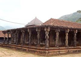
Thirunelly temple-32 kms north east of Mananthavady and 66 kms from Kalpetta. Nestled amidst mountains and forests, this ancient riverside temple is a fine specimen of classical Kerala temple architecture. It is Known asThekkan Kashi/Dakshina Kashi (Kasi of the South) and surrounded by Kambamala, Karimala and Varadiga.Legend is that this temple was dedicated by the Creator,Lord Brahma to propitiate the Preserver, Lord Vishnu. The idols is in the form of Chathurbhuja.

The Shrine is shielded with 30 granite columns and the ground is paved with huge square pieces of granite. The crystal clear water of the Papanashini river running downhill add to the enchantment of the place. This temple draws pilgrims from allover, primarily for ancestral rites.

A short walk from Thirunelli temple is the clear mountain spring known as Papanasini. A ritual dip here is believed to wash one away of all worldly sins. Pakshipathalam, an interesting trekking centre, is about 10 kms away from here.

Distances from: KPA-66 Km, SBY-71 Km, MDY-32 Km
Valliyoorkavu Bhagavathi Temple-8 kms east of Mananthavady. The temple is dedicated to the mother goddess manifest in the three principal forms of Vana Durga, Bhadrakali and Jala Durga.The two week long festival in February/March is a major event attended by thousands of people.

Distances from: KPA-24 Km, SBY-31 Km, MDY-5 Km

ACCESSIBILITY


Telephone access code: + 91 4936
Air: Nearest airport: Kozhikode
Rail: Nearest railway station: Kozhikode Major towns in the district and distance from the nearest railway station: Kalpetta: 72 km from Kozhikode, Mananthavady: 80 km from Thalassery and 106 km from Kozhikode, Sulthan Bathery: 97 km from Kozhikode, Vythiri: 60 km from Kozhikode.
Road: Well connected by roads from Kozhikode, Kannur, Ooty (175 km from Kalpetta) and Mysore (140 km from Kalpetta).
Tourist information offices: District Tourism Promotion Council, Kalpetta Telefax: 202134 Pookot Ph: 255207 Email: info@dtpcwayanad.com www.dtpcwayanad.com, Tourist Information Centre, Collectorate Ph: + 91 4936 204441, Govt. Guest House, Sulthan Bathery Ph: + 91 4936 220225